Subsidence and Deformation Data Module
Geological instability can lead to differential movement of the ground, which in turn impacts the safety of various infrastructure such as urban roads and energy/power facilities.
The subsidence and deformation monitoring data suite of TerraQuanta is based on InSAR measurement technology to capture surface deformation. Compared with conventional measurement techniques, InSAR technology provides all-weather deformation measurements that does not require any on-site installation, and has the advantages of wide monitoring range, high sensitivity, traceability, adaptability. Non-contact precise measurement can be carried out to identify the risk of early-stage geological disaster.
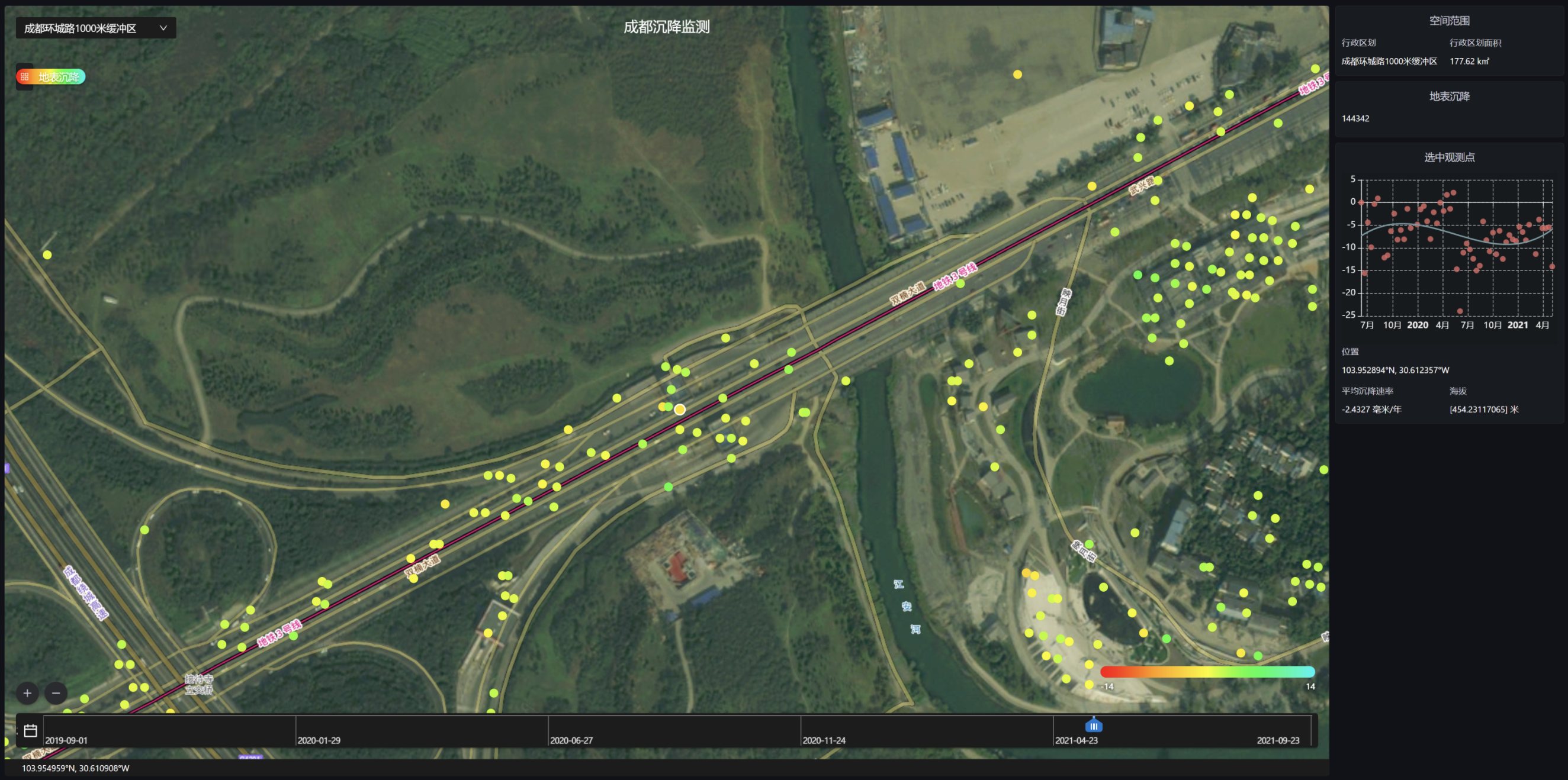
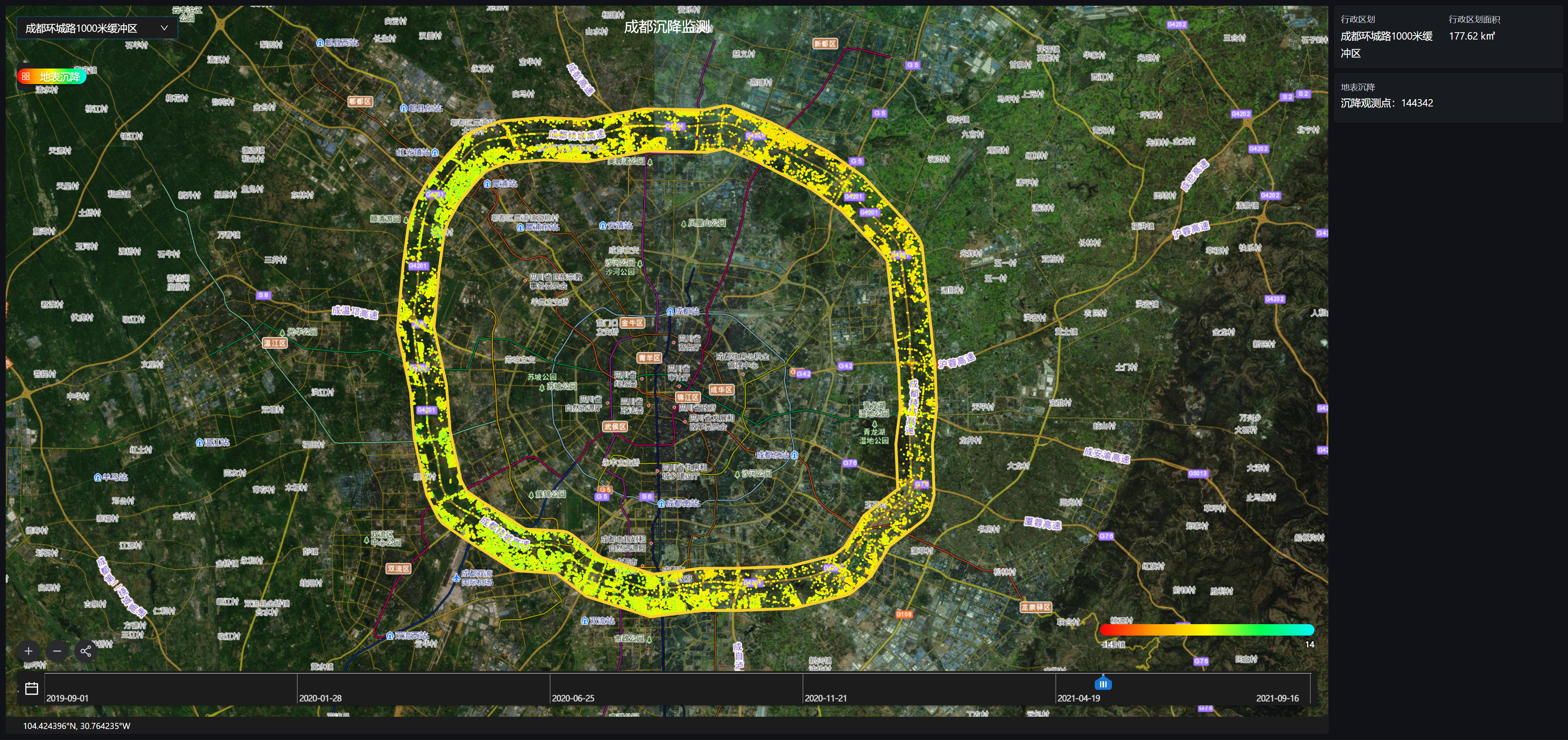
Subsidence Monitoring of Highway Subgrade
Core Index
Technical Index | Data |
|---|---|
| Data Format | Vector |
| Spatial Resolution | Standard: 13 x 2 Meters |
| Time Resolution | Standard: 12 Days. Max: 4 Days |
| Serviceable Area | Global |
| Service Mode | SDK, SaaS, WMTS |
| Main Data Source | TerraQuanta Multi-source Radar Input (TMRI) |
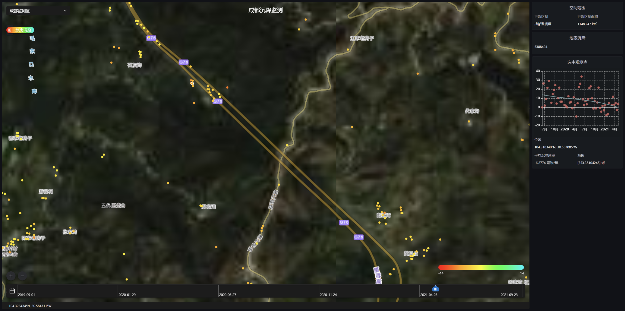
Monitoring of Expressway High Slope
Core Index
Technical Index | Data |
|---|---|
| Data Format | Vector |
| Spatial Resolution | Standard: 13 x 2 Meters |
| Time Resolution | Standard: 12 Days. Max: 4 Days |
| Serviceable Area | Global |
| Service Mode | SDK, SaaS, WMTS |
| Main Data Source | TerraQuanta Multi-source Radar Input (TMRI) |
Monitoring of Tunnel Entrances and Surrounding Environment
Core Index
Technical Index | Data |
|---|---|
| Data Format | Vector |
| Spatial Resolution | Standard: 13 x 2 Meters |
| Time Resolution | Standard: 12 Days. Max: 4 Days |
| Serviceable Area | Global |
| Service Mode | SDK, SaaS, WMTS |
| Main Data Source | TerraQuanta Multi-source Radar Input (TMRI) |
Monitoring of Expressway Bridges
Core Index
Technical Index | Data |
|---|---|
| Data Format | Vector |
| Spatial Resolution | Standard: 13 x 2 Meters |
| Time Resolution | Standard: 12 Days. Max: 4 Days |
| Serviceable Area | Global |
| Service Mode | SDK, SaaS, WMTS |
| Main Data Source | TerraQuanta Multi-source Radar Input (TMRI) |
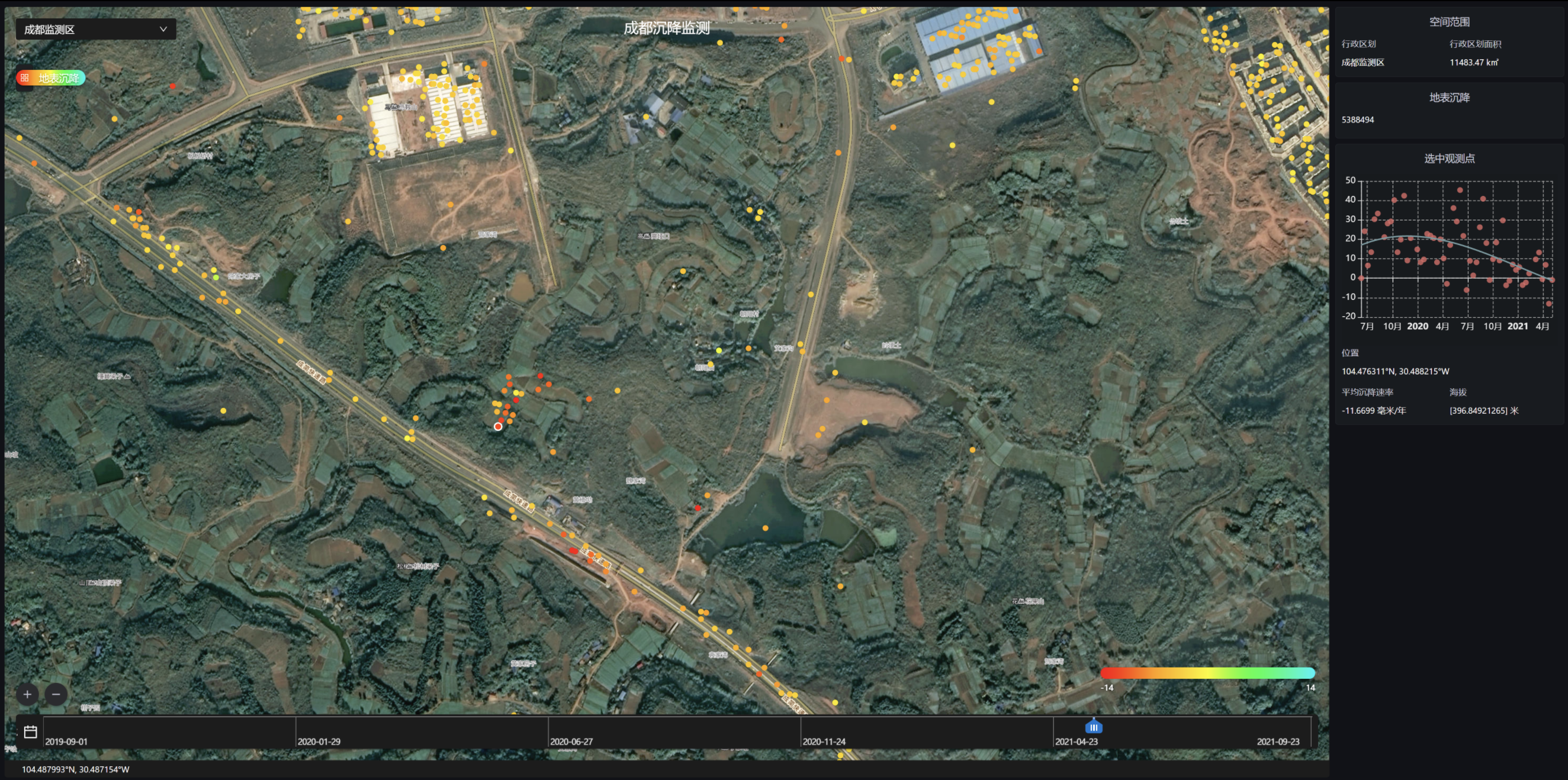
Early Identification of Potential Geological Hazards Along the Road
Core Index
Technical Index | Data |
|---|---|
| Data Format | Vector |
| Spatial Resolution | Standard: 13 x 2 Meters |
| Time Resolution | Standard: 12 Days. Max: 4 Days |
| Serviceable Area | Global |
| Service Mode | SDK, SaaS, WMTS |
| Main Data Source | TerraQuanta Multi-source Radar Input (TMRI) |
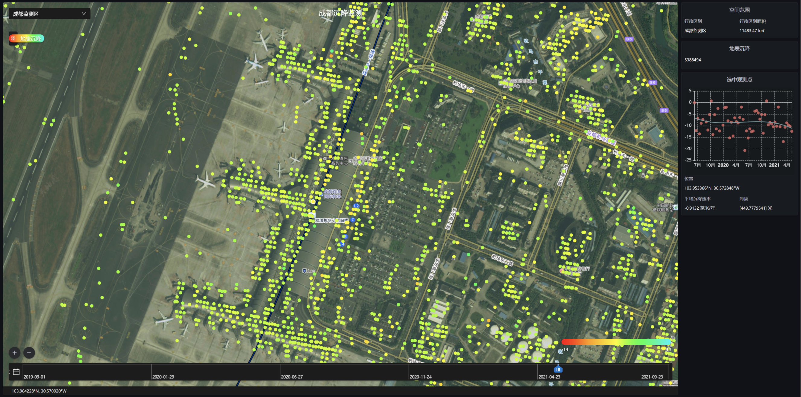
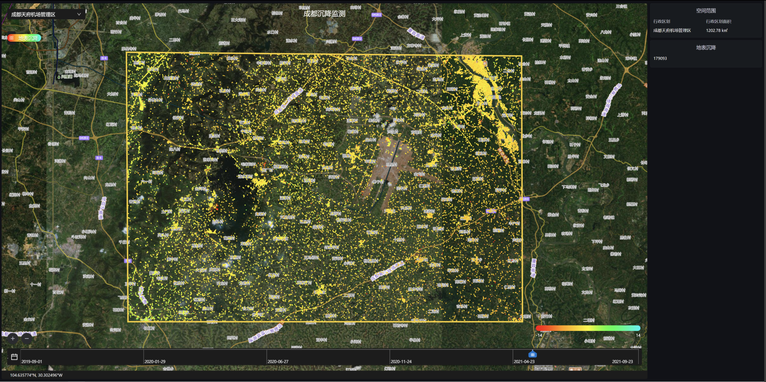
Subsidence Monitoring of Airport Terminal
Core Index
Technical Index | Data |
|---|---|
| Data Format | Vector |
| Spatial Resolution | Standard: 13 x 2 Meters |
| Time Resolution | Standard: 12 Days. Max: 4 Days |
| Serviceable Area | Global |
| Service Mode | SDK, SaaS, WMTS |
| Main Data Source | TerraQuanta Multi-source Radar Input (TMRI) |
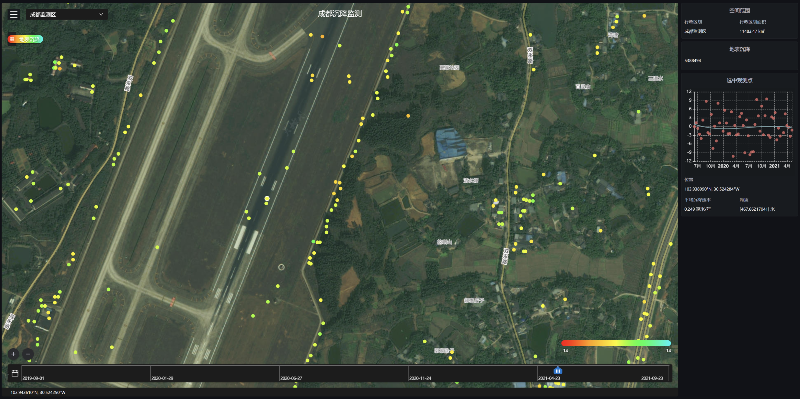
Subsidence Monitoring of Airport Runway Area
Core Index
Technical Index | Data |
|---|---|
| Data Format | Vector |
| Spatial Resolution | Standard: 13 x 2 Meters |
| Time Resolution | Standard: 12 Days. Max: 4 Days |
| Serviceable Area | Global |
| Service Mode | SDK, SaaS, WMTS |
| Main Data Source | TerraQuanta Multi-source Radar Input (TMRI) |
Monitoring of Infrastructures Surrounding Airports
Core Index
Technical Index | Data |
|---|---|
| Data Format | Vector |
| Spatial Resolution | Standard: 13 x 2 Meters |
| Time Resolution | Standard: 12 Days. Max: 4 Days |
| Serviceable Area | Global |
| Service Mode | SDK, SaaS, WMTS |
| Main Data Source | TerraQuanta Multi-source Radar Input (TMRI) |
Subsidence Monitoring of Urban Railway Traffic
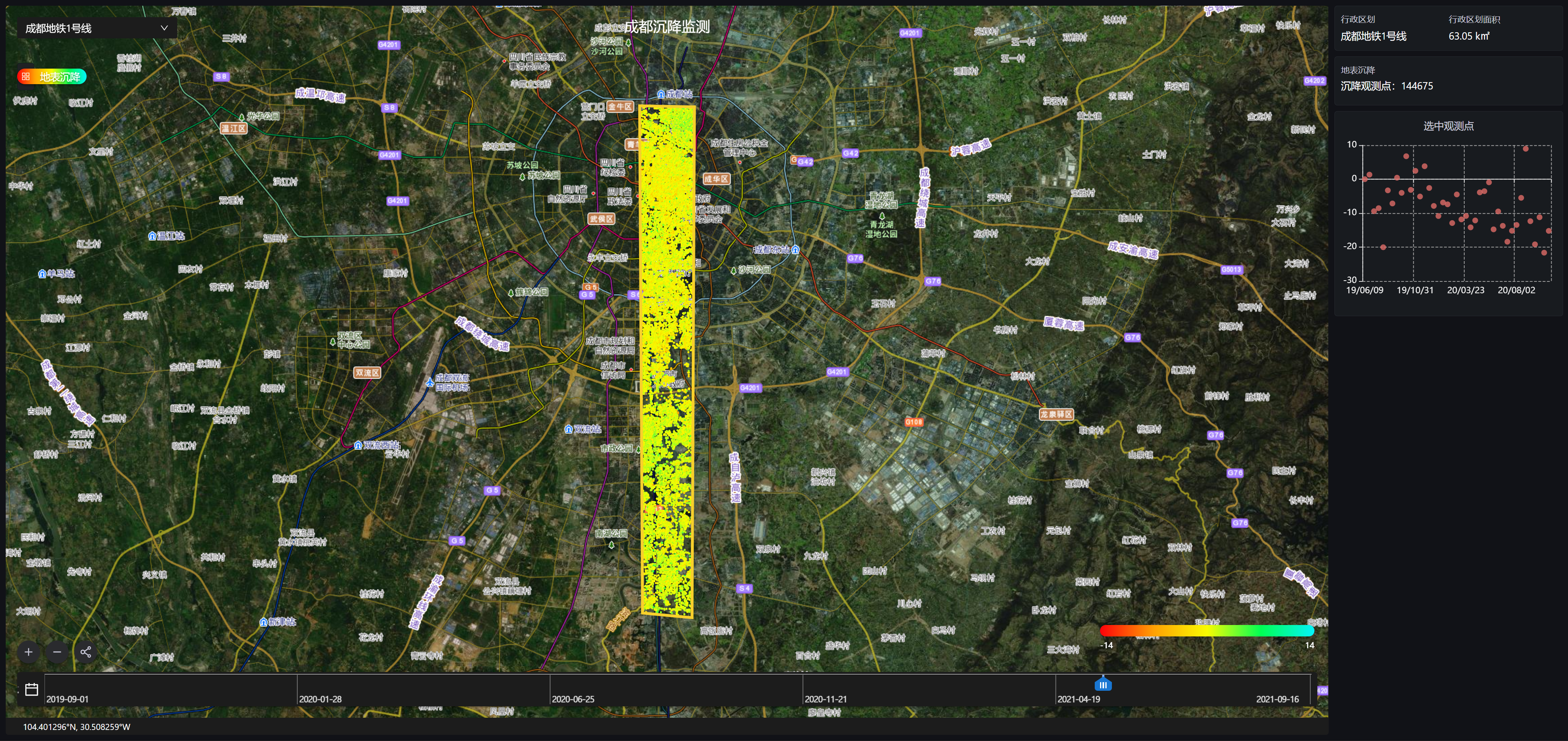
Core Index
Technical Index | Data |
|---|---|
| Data Format | Vector |
| Spatial Resolution | Standard: 13 x 2 Meters |
| Time Resolution | Standard: 12 Days. Max: 4 Days |
| Serviceable Area | Global |
| Service Mode | SDK, SaaS, WMTS |
| Main Data Source | TerraQuanta Multi-source Radar Input (TMRI) |
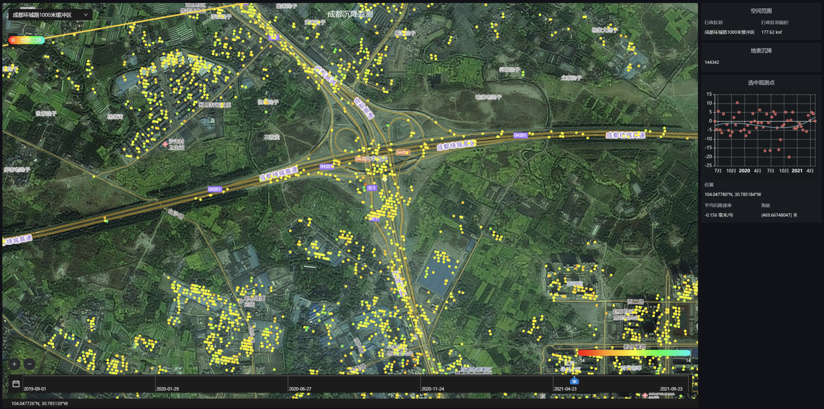
Monitoring of Urban Geological Safety Condition
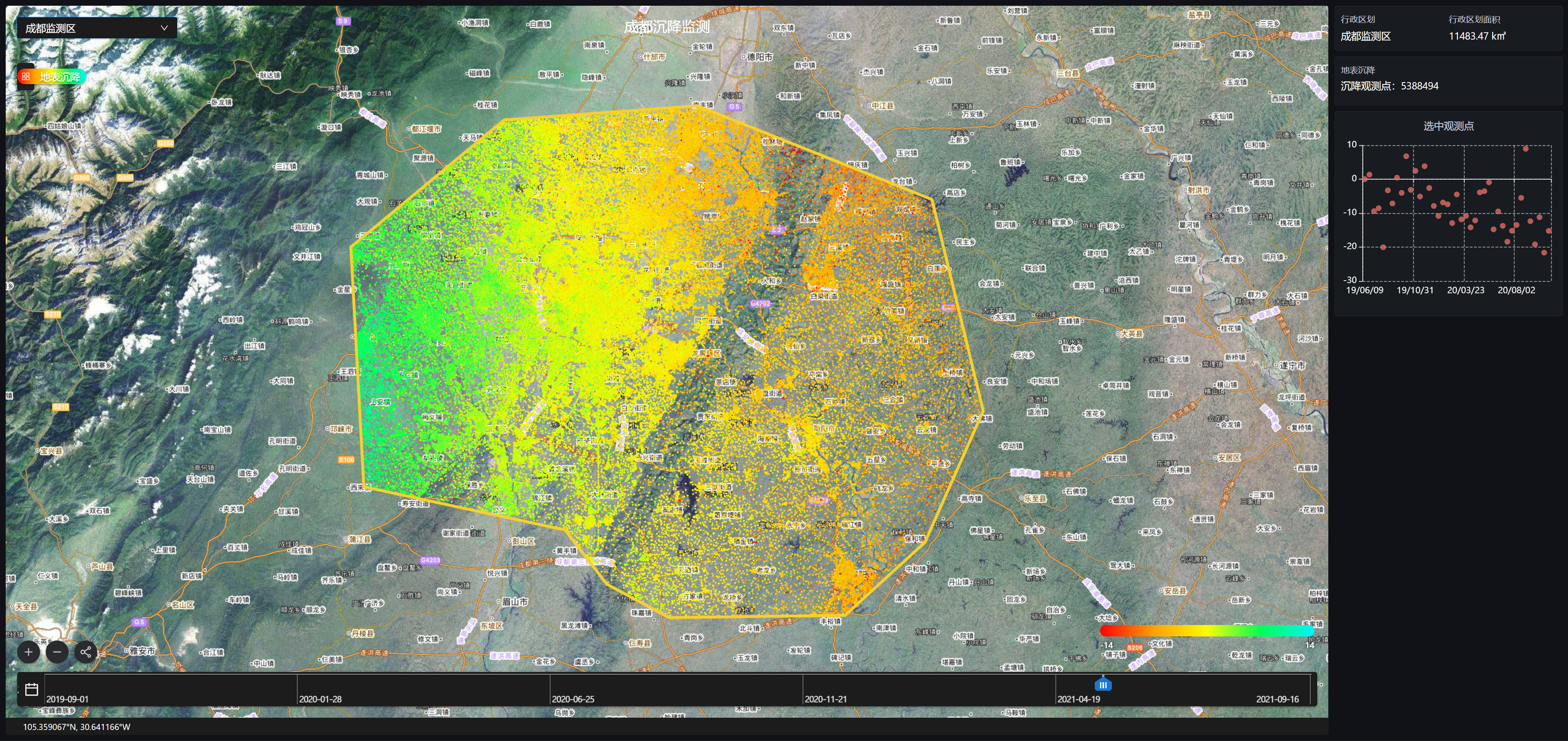
Core Index
Technical Index | Data |
|---|---|
| Data Format | Vector |
| Spatial Resolution | Standard: 13 x 2 Meters |
| Time Resolution | Standard: 12 Days. Max: 4 Days |
| Serviceable Area | Global |
| Service Mode | SDK, SaaS, WMTS |
| Main Data Source | TerraQuanta Multi-source Radar Input (TMRI) |
Monitoring of Important Urban Structures
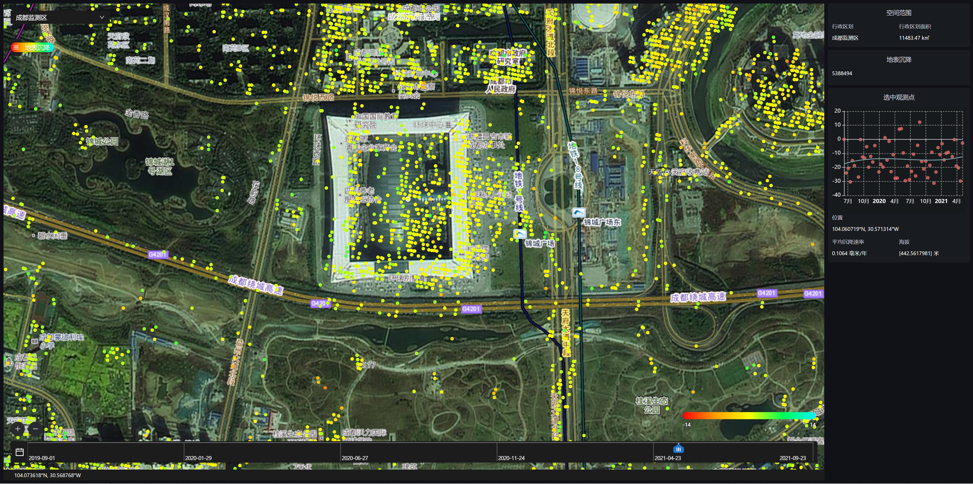
Core Index
Technical Index | Data |
|---|---|
| Data Format | Vector |
| Spatial Resolution | Standard: 13 x 2 Meters |
| Time Resolution | Standard: 12 Days. Max: 4 Days |
| Serviceable Area | Global |
| Service Mode | SDK, SaaS, WMTS |
| Main Data Source | TerraQuanta Multi-source Radar Input (TMRI) |