TerraQuanta SaaS User’s Manual
Data visualization alone can create tremendous value. No need for installation, debugging, or training, TerraQuanta’s standardized spatiotemporal data SaaS service helps spatiotemporal data users to view various data products and use various functions designed by us through a simple login.
SaaS Directions
Users can click register on the upper right corner of the website of TerraQuanta to access a free trial of TerraQuanta’s SaaS service
After registration, the user can access the TerraQuanta SaaS Service webpage to freely browse the demo data service
Introduction to SaaS Service Functions:
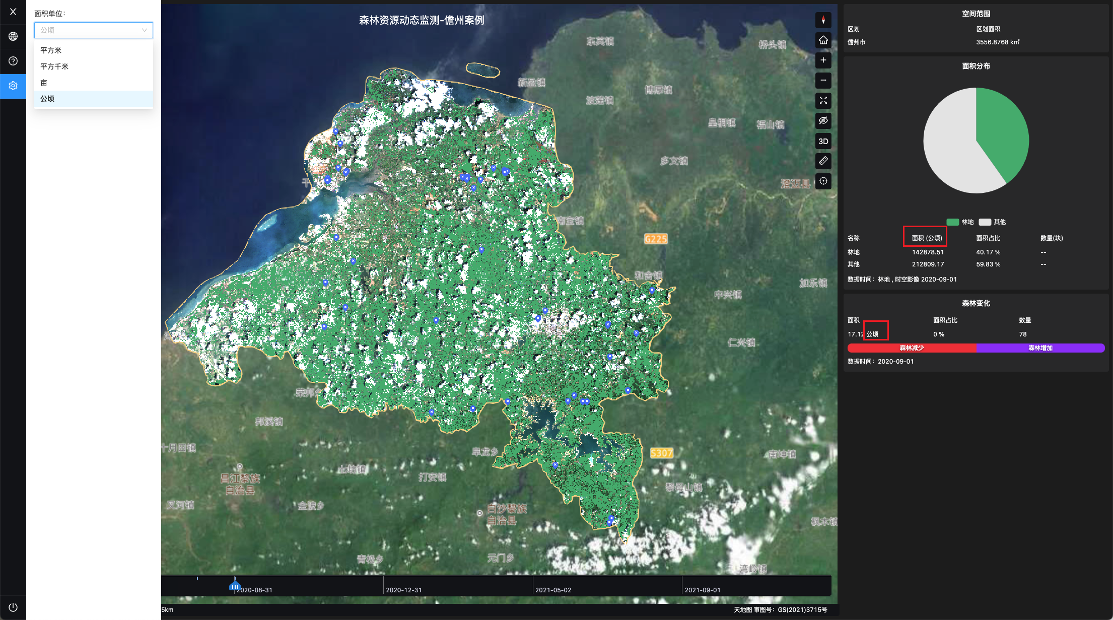
On the TerraQuanta Service webpage, users can select three elements: data product type, spatial range, time, to view different spatiotemporal data on the map. Statistical analysis of the chosen spatiotemporal data is also provided on the right side of the page
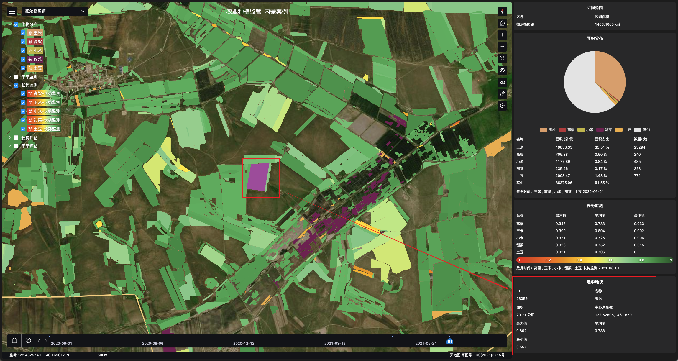
Data product types contain features and feature properties, which can be freely selected on the left side of the page.
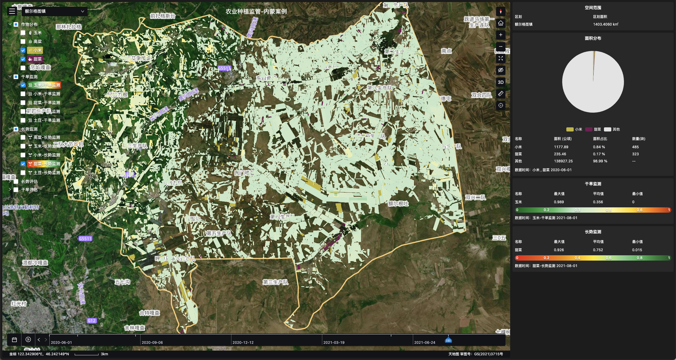
After selecting features, the user can choose to see the property data of the feature. The figure below shows the use effect of the monitoring data of selected crop in agricultural planting supervision service.
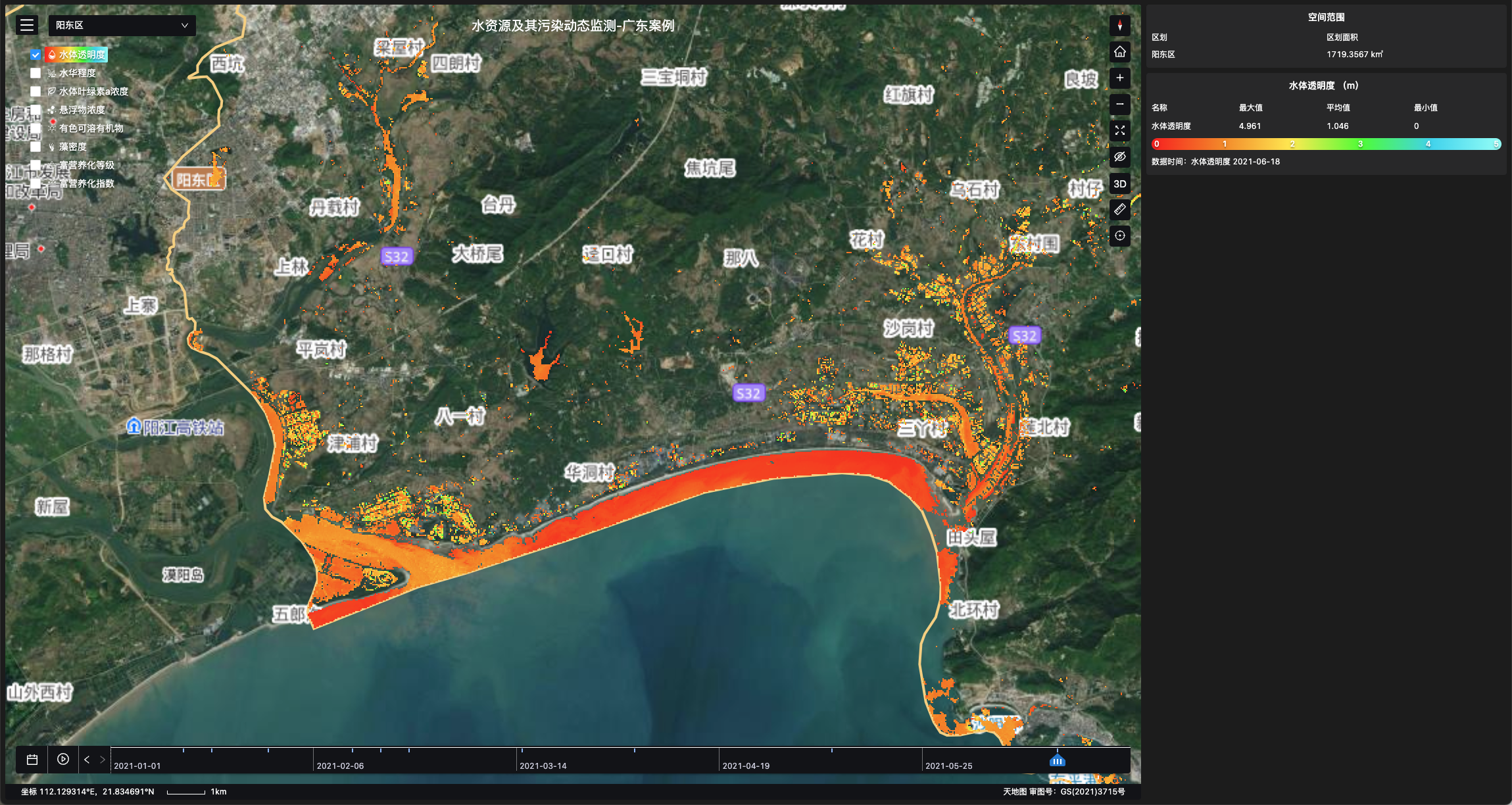
Of course, in some scenarios, it is also possible to view feature properties directly in SaaS services. As shown in the figure below, you can view the effect of water quality parameter data in water environment service.