Forest Data Module List
Using the advantages of high resolution remote sensing satellites, such as short revisit cycle, wide coverage, stable data services, TerraQuanta has built a sample library of forest resources, and, through independent research and development of the AI algorithms, developed classification models suitable for different area. TerraQuanta also has quickly generated distribution maps of trees, relying on the high performance space data engine, and provides data basis for different scenarios, such as dynamic monitoring of forestry resources, supervision of human activities in protected natural areas, and regular monitoring of forest fires.
Forest and Grass Coverage Monitoring
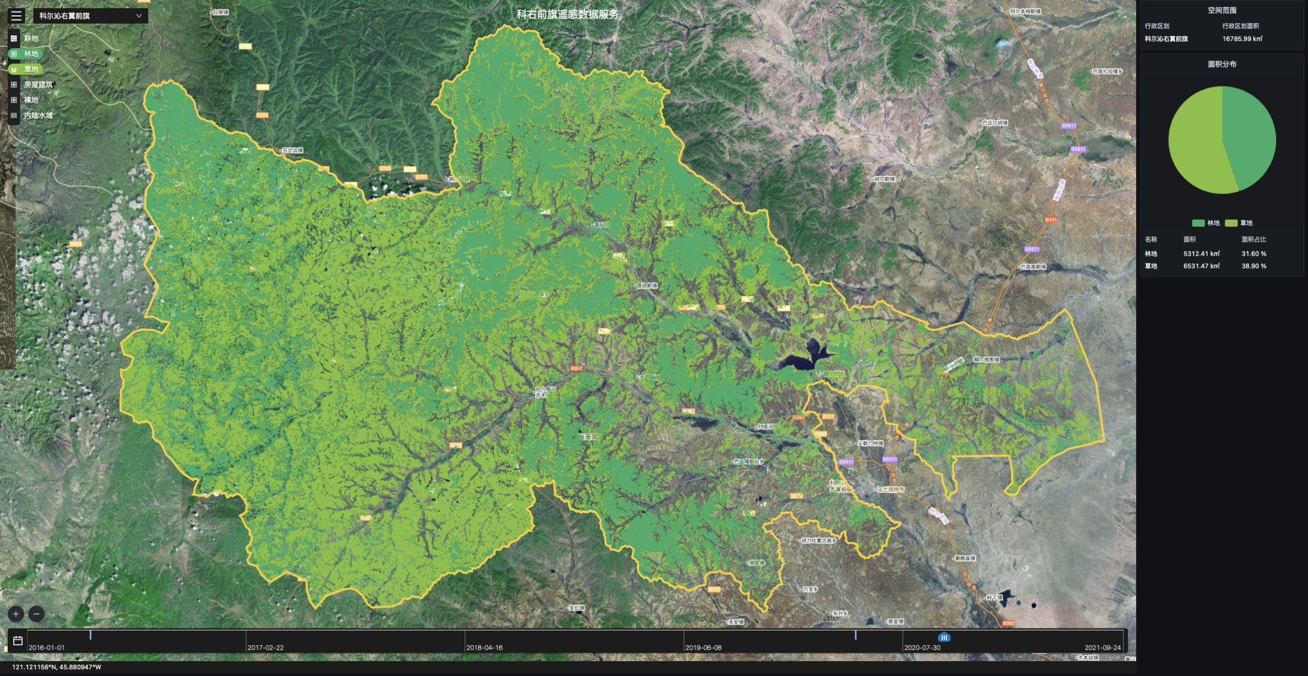
Core Index
Technical Index | Data |
|---|---|
| Data Format | Raster |
| Spatial Resolution | Max: 0.5 meters, Standard: 10 meters |
| Time Resolution | Max: Monthly, Standard: Quarterly |
| Servicable Area | Global |
| Service Mode | SDK, SaaS, WMTS |
| Main Data Source | TerraQuanta Multi-source Spectrum Input (TMSI) |
Forest Change Monitoring
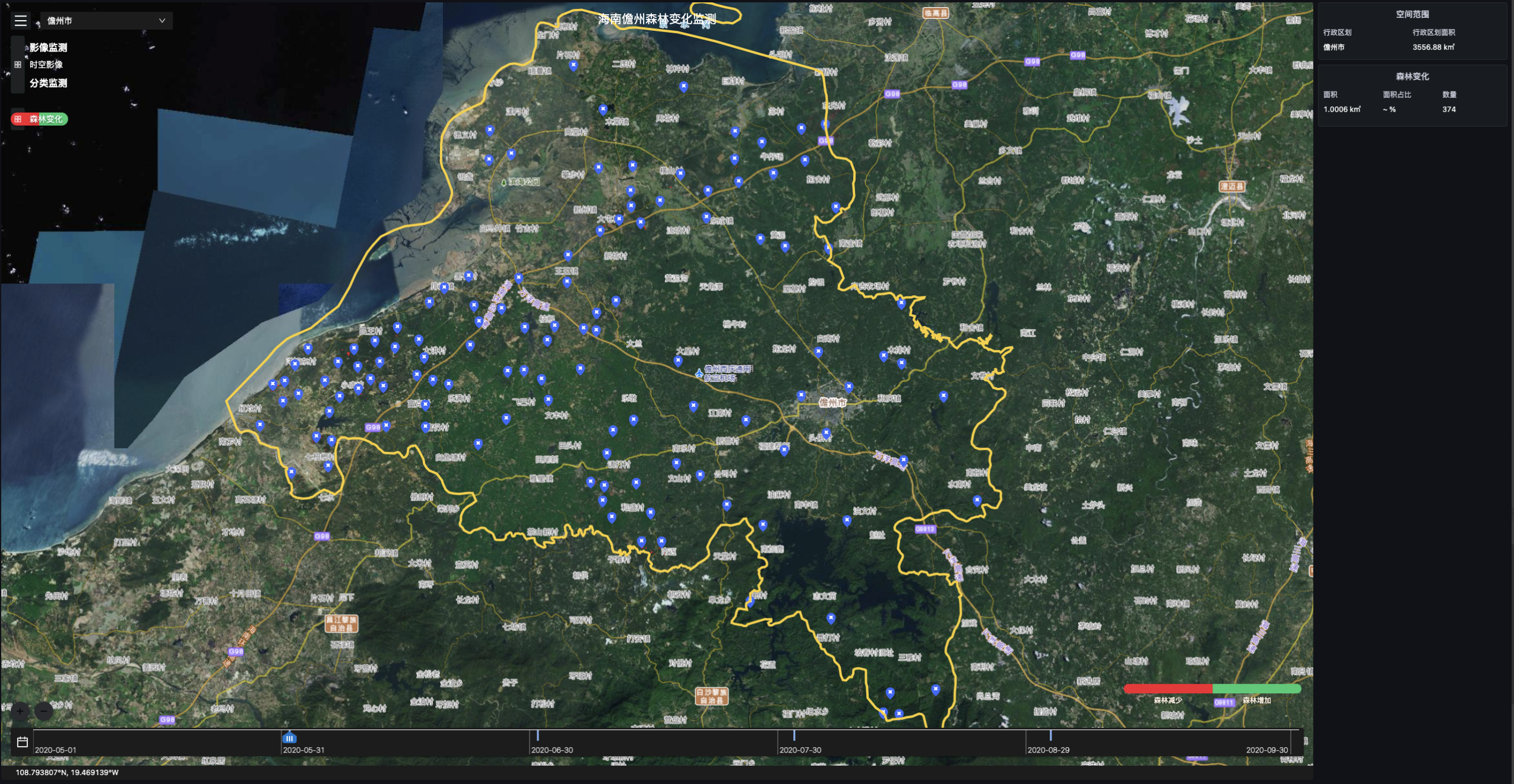
Core Index
Technical Index | Data |
|---|---|
| Data Format | Vector |
| Attribute Information | Change Map Spot Area. Change Attributes |
| Spatial Resolution | Max: 0.5 meters, Standard: 10 meters |
| Time Resolution | Max: Monthly, Standard: Quarterly |
| Servicable Area | Global |
| Service Mode | SDK, SaaS, WMTS |
| Main Data Source | TerraQuanta Multi-source Spectrum Input (TMSI) |
Fire Dynamic Monitoring
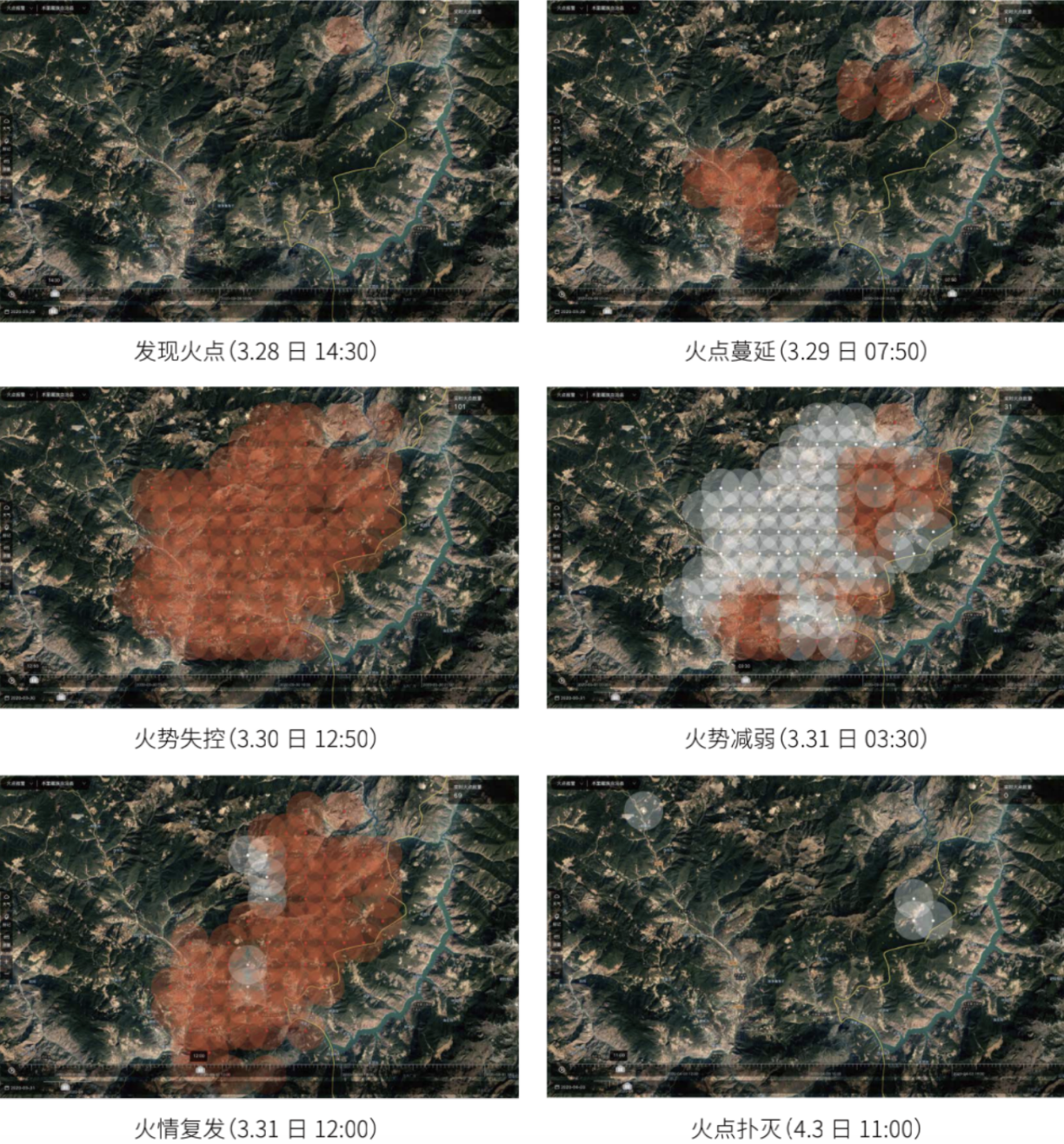
Core Index
Technical Index | Data |
|---|---|
| Data Format | Vector |
| Spatial Resolution | 375m~2km |
| Time Resolution | Every 5 minutes |
| Servicable Area | Global |
| Service Mode | SDK, SaaS, WMTS |
| Main Data Source | TerraQuanta Multi-source Spectrum Input (TMSI) |
Fire Area Identification
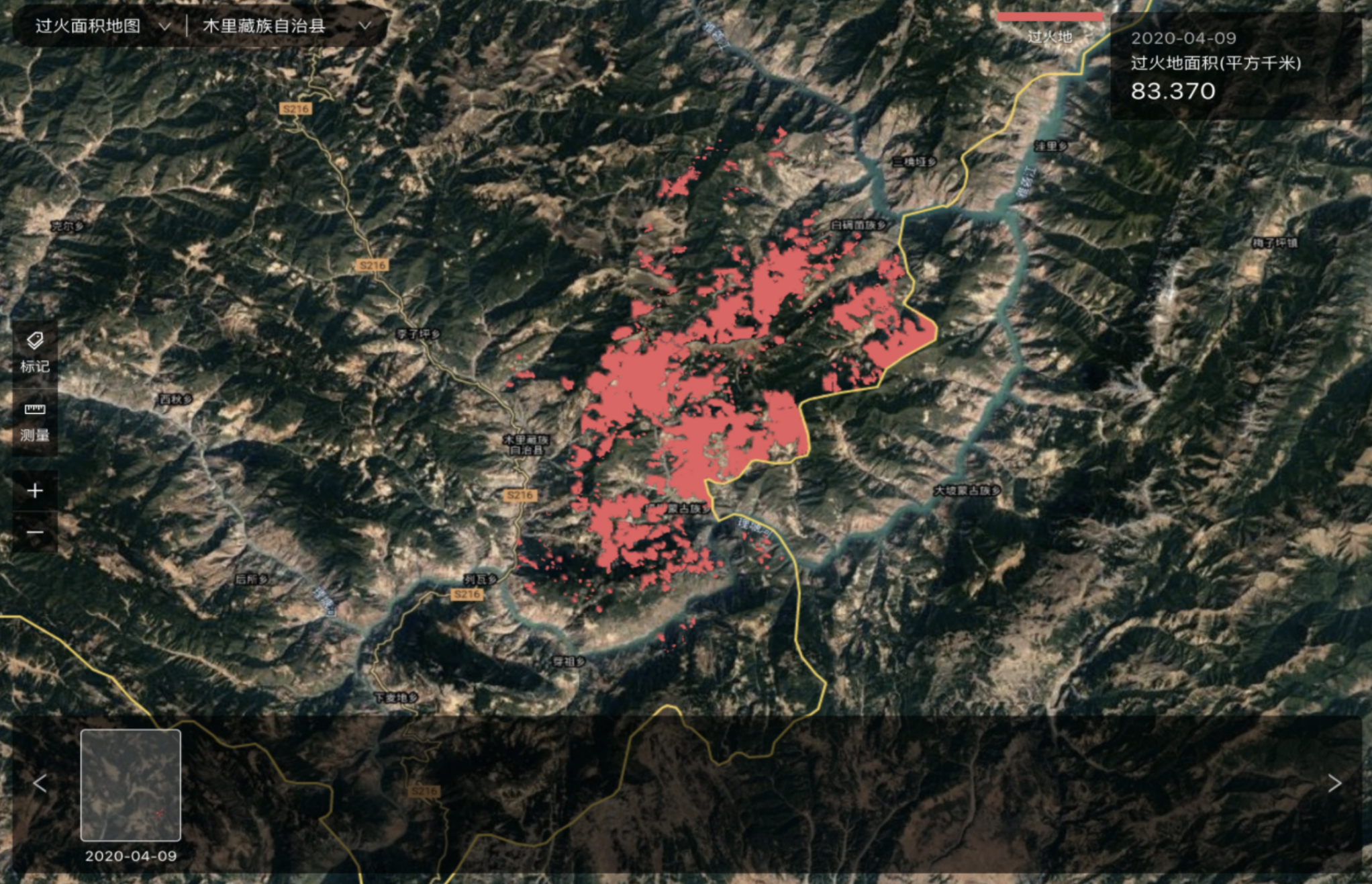
Core Index
Technical Index | Data |
|---|---|
| Data Format | Raster, Vector |
| Spatial Resolution | Max: 0.5 meters, Standard: 10 meters |
| Time Resolution | Updated Irregularly |
| Servicable Area | Global |
| Service Mode | SDK, SaaS, WMTS |
| Main Data Source | TerraQuanta Multi-source Spectrum Input (TMSI), TerraQuanta Multi-source Radar Input (TMRI)) |