Water Environment Data Modules
Water body health is an important social issue concerned by governments at all levels and the public. However, due to the extensive distribution of water systems and numerous pollution sources, conventional monitoring methods often rely on ground sensors and focus on “points”, which cannot achieve global monitoring. As a supplement to conventional monitoring method, satellite remote sensing can analyze time-series variation of water pollusion on a macro level, and locate polluted lake and river rapidly, achieving the new monitoring mode: “View from the sky, search on the internet, look on the ground.”
TerraQuanta collects abundant satellites resources to routinely monitor water bodies such as rivers, lakes, and ponds at large-scale and high-frequency, providing a distribution diagram of water quality parameters for all water bodies in certain area, which clearly reflects the water quality distribution trend and its dynamic changing situations. This will provide necessary evidences for preventing and controlling the occurrence and development of water pollution, as well as aiding users in making decisions with scientific data in water environment monitoring and protection.
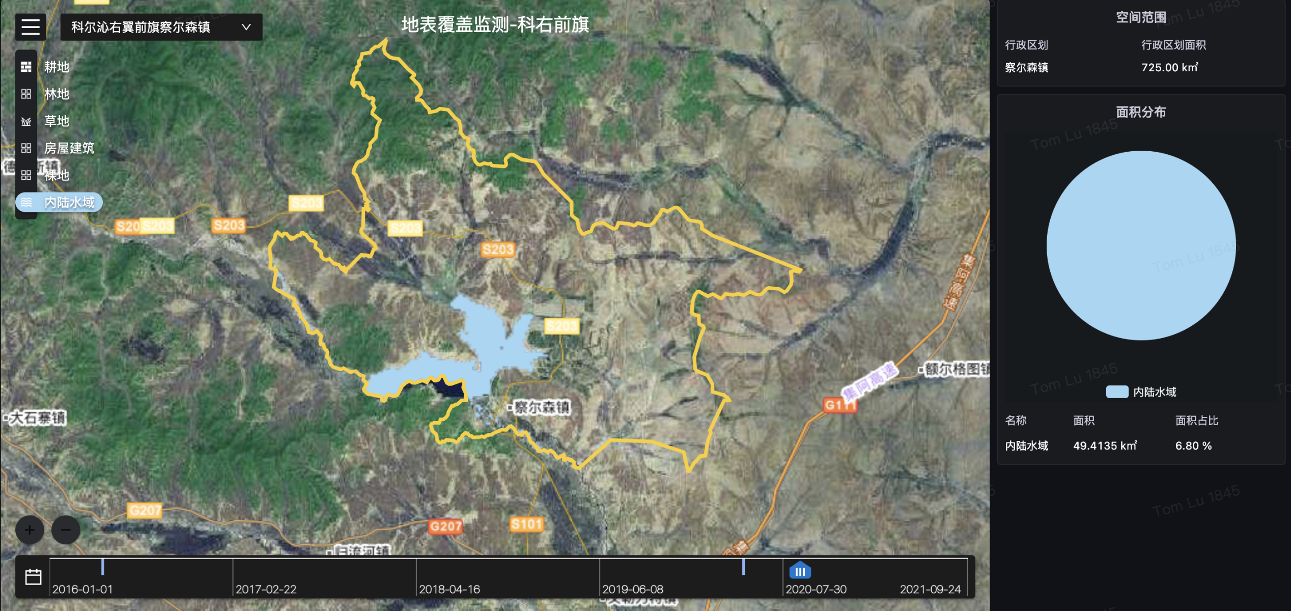
Water Body Identification
Core Index
Technical Index | Data |
|---|---|
| Data Format | Vector Raster |
| Spatial Resolution | Max: 0.5 meters, Standard: 10 meters |
| Time Resolution | Standard: Quarterly Max: Monthly |
| Servicable Area | Global |
| Service Mode | SDK, SaaS, WMTS |
| Main Data Source | TerraQuanta Multi-source Spectrum Input (TMSI) |
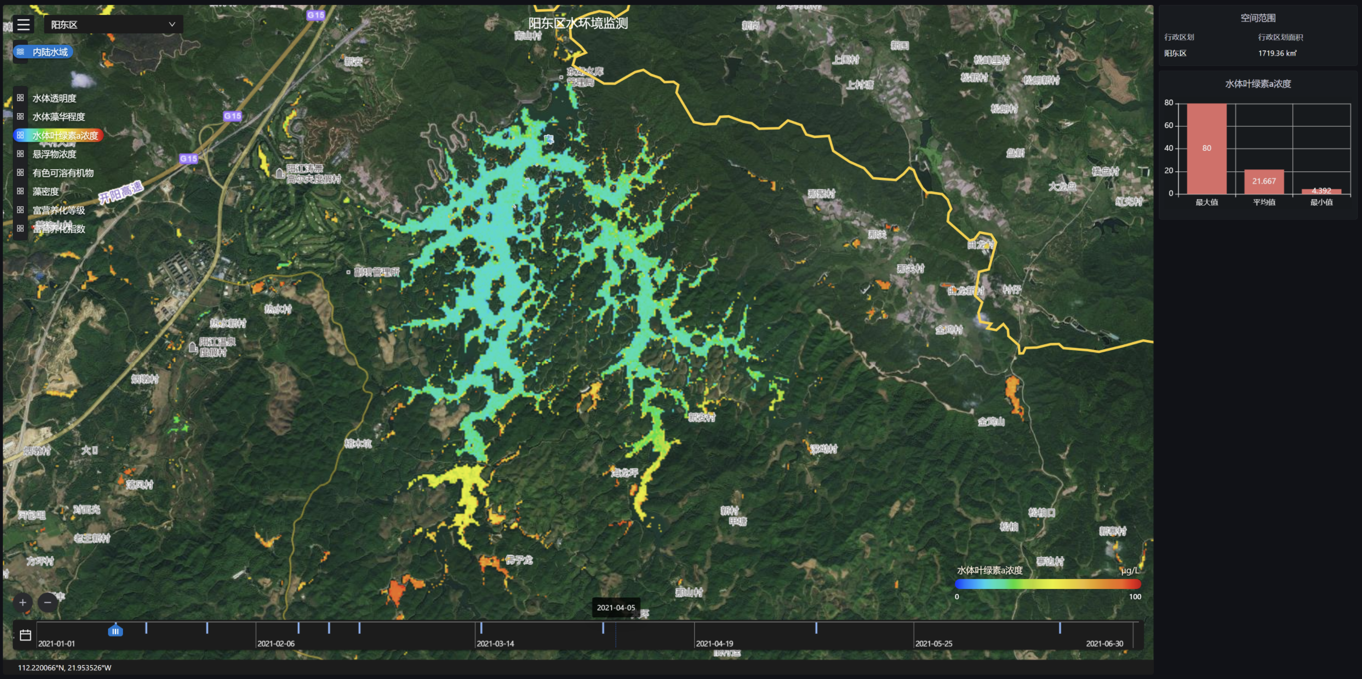
Chlorophyll A Concentration Monitoring
Core Index
Technical Index | Data |
|---|---|
| Data Format | Vector Raster |
| Spatial Resolution | Standard: 10 meters |
| Time Resolution | 3~5 Days |
| Servicable Area | Global |
| Service Mode | SDK, SaaS, WMTS |
| Main Data Source | TerraQuanta Multi-source Spectrum Input (TMSI) |
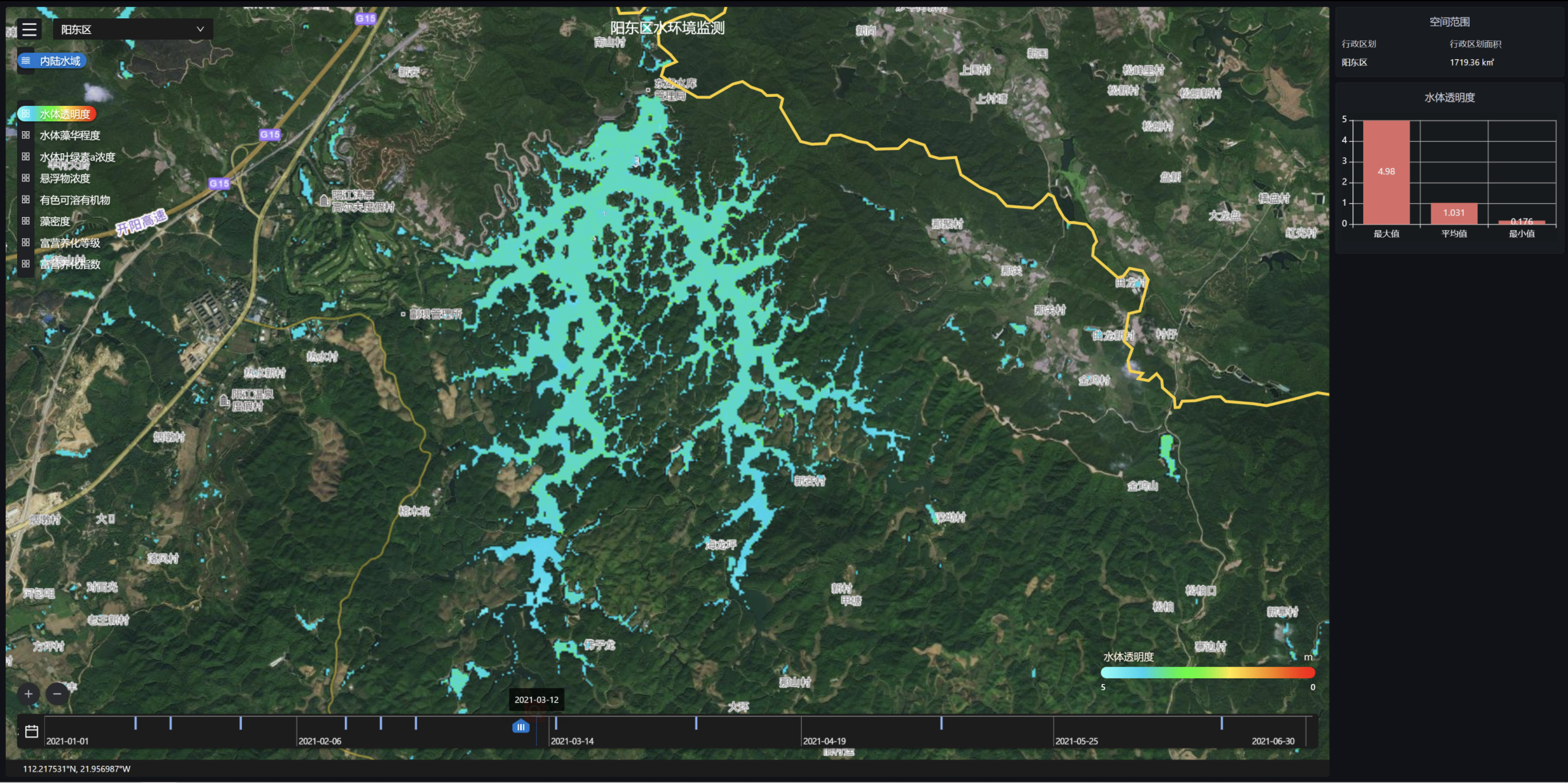
Transparency Monitoring
Core Index
Technical Index | Data |
|---|---|
| Data Format | Vector Raster |
| Spatial Resolution | Standard: 10 meters |
| Time Resolution | 3~5 Days |
| Servicable Area | Global |
| Service Mode | SDK, SaaS, WMTS |
| Main Data Source | TerraQuanta Multi-source Spectrum Input (TMSI) |
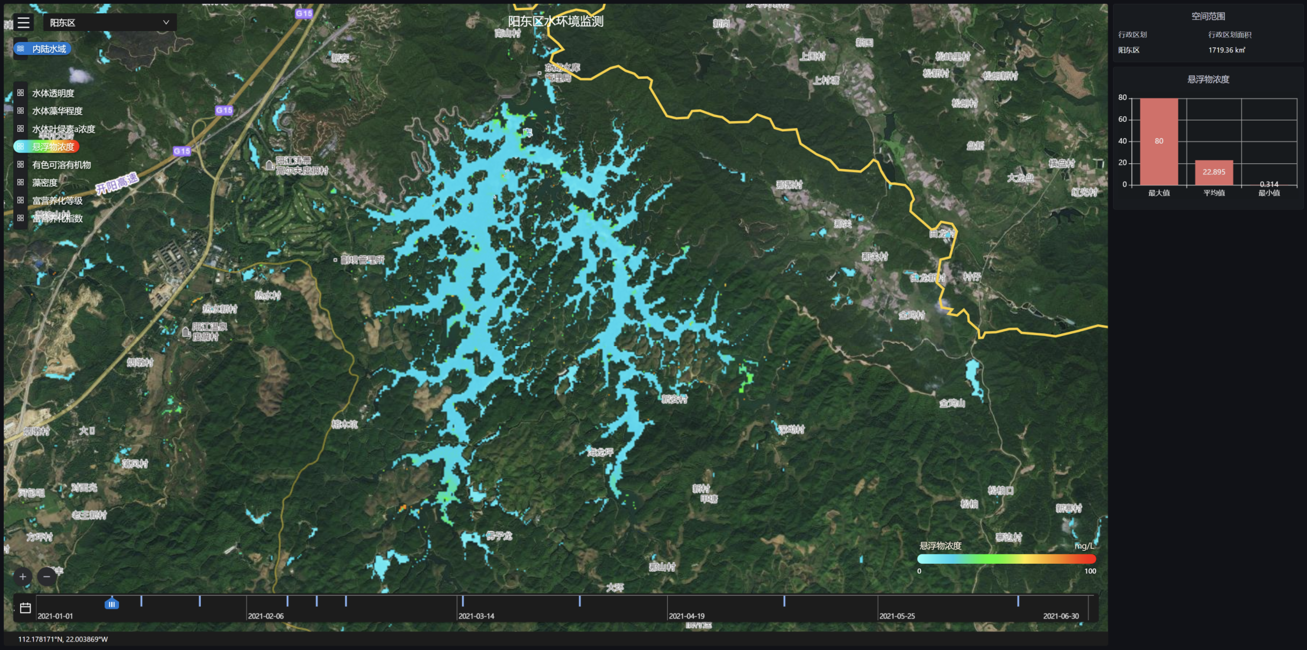
Suspended Solids Monitoring
Core Index
Technical Index | Data |
|---|---|
| Data Format | Vector Raster |
| Spatial Resolution | Standard: 10 meters |
| Time Resolution | 3~5 Days |
| Servicable Area | Global |
| Service Mode | SDK, SaaS, WMTS |
| Main Data Source | TerraQuanta Multi-source Spectrum Input (TMSI) |
Monitoring of Colored Soluble Organic Matter
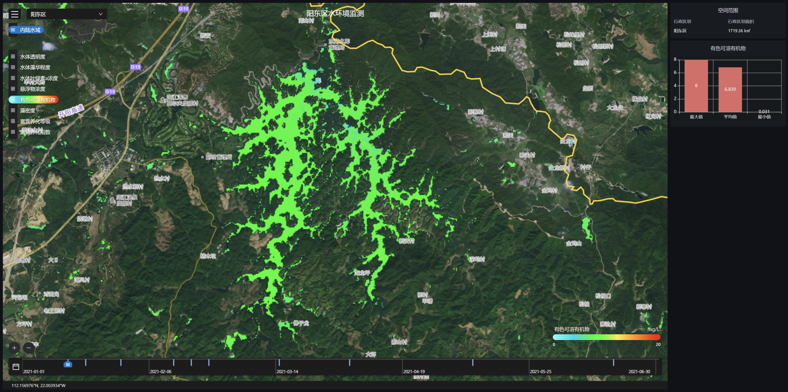
Core Index
Technical Index | Data |
|---|---|
| Data Format | Vector Raster |
| Spatial Resolution | Standard: 10 meters |
| Time Resolution | 3~5 Days |
| Servicable Area | Global |
| Service Mode | SDK, SaaS, WMTS |
| Main Data Source | TerraQuanta Multi-source Spectrum Input (TMSI) |
Algae Density Monitoring
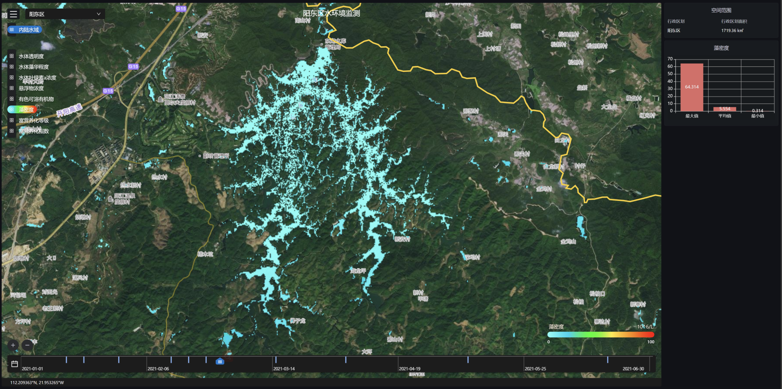
Core Index
Technical Index | Data |
|---|---|
| Data Format | Vector Raster |
| Spatial Resolution | Standard: 10 meters |
| Time Resolution | 3~5 Days |
| Servicable Area | Global |
| Service Mode | SDK, SaaS, WMTS |
| Main Data Source | TerraQuanta Multi-source Spectrum Input (TMSI) |
Algae Bloom Intensity Monitoring
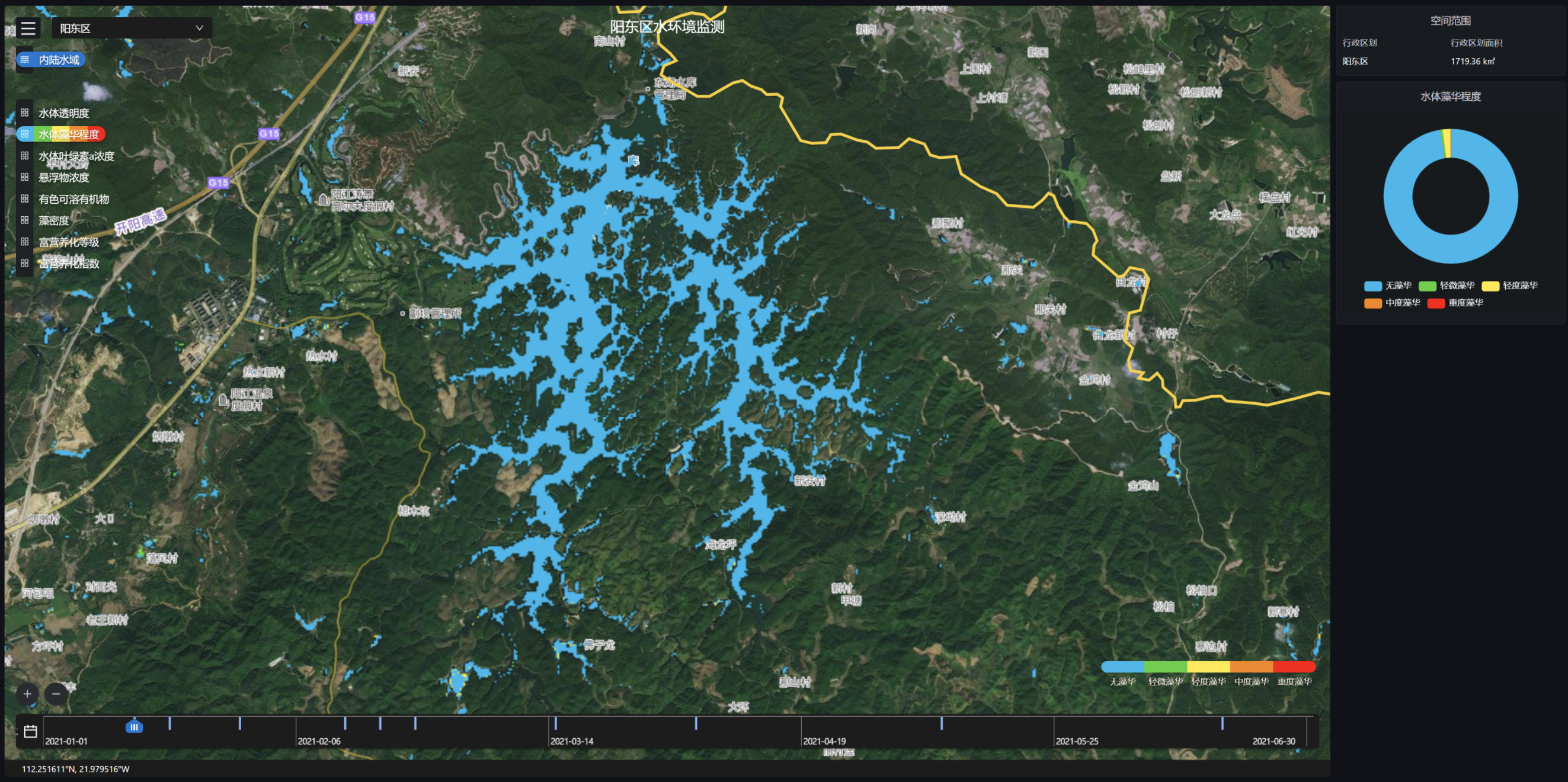
Core Index
Technical Index | Data |
|---|---|
| Data Format | Vector Raster |
| Spatial Resolution | Standard: 10 meters |
| Time Resolution | 3~5 Days |
| Servicable Area | Global |
| Service Mode | SDK, SaaS, WMTS |
| Main Data Source | TerraQuanta Multi-source Spectrum Input (TMSI) |
Eutrophication Monitoring (Qualitative)
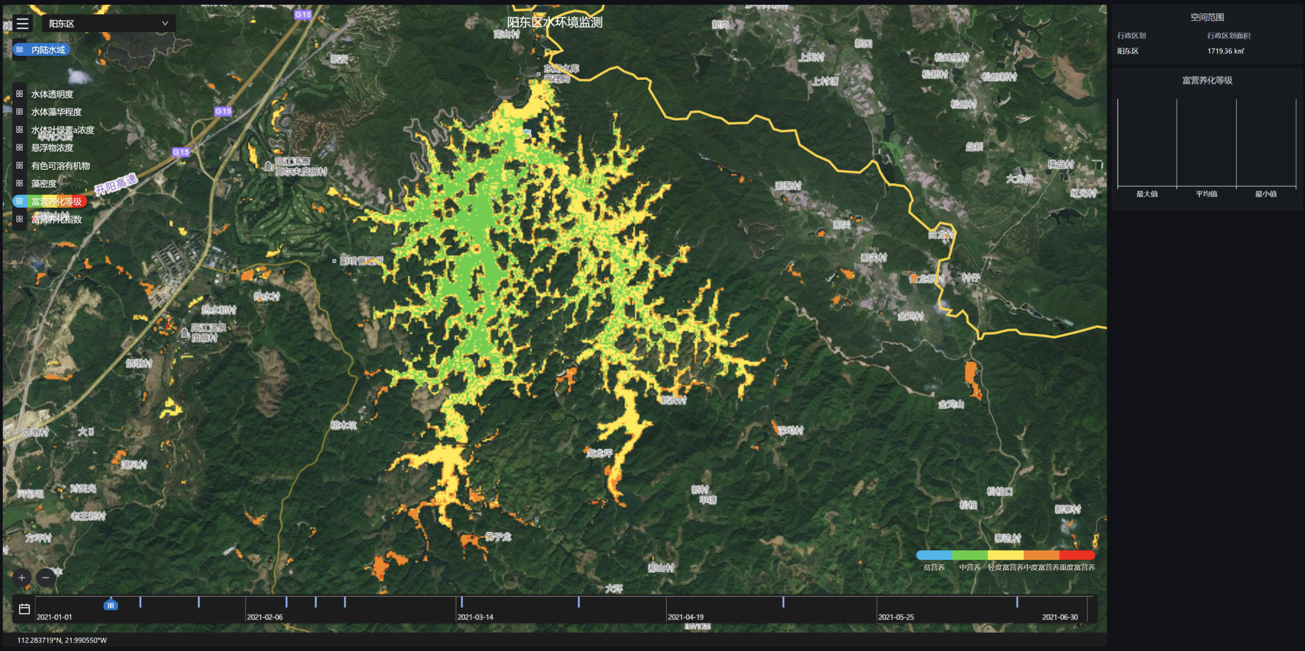
Core Index
Technical Index | Data |
|---|---|
| Data Format | Vector Raster |
| Spatial Resolution | Standard: 10 meters |
| Time Resolution | 3~5 Days |
| Servicable Area | Global |
| Service Mode | SDK, SaaS, WMTS |
| Main Data Source | TerraQuanta Multi-source Spectrum Input (TMSI) |
Eutrophication Monitoring (Quantitative)
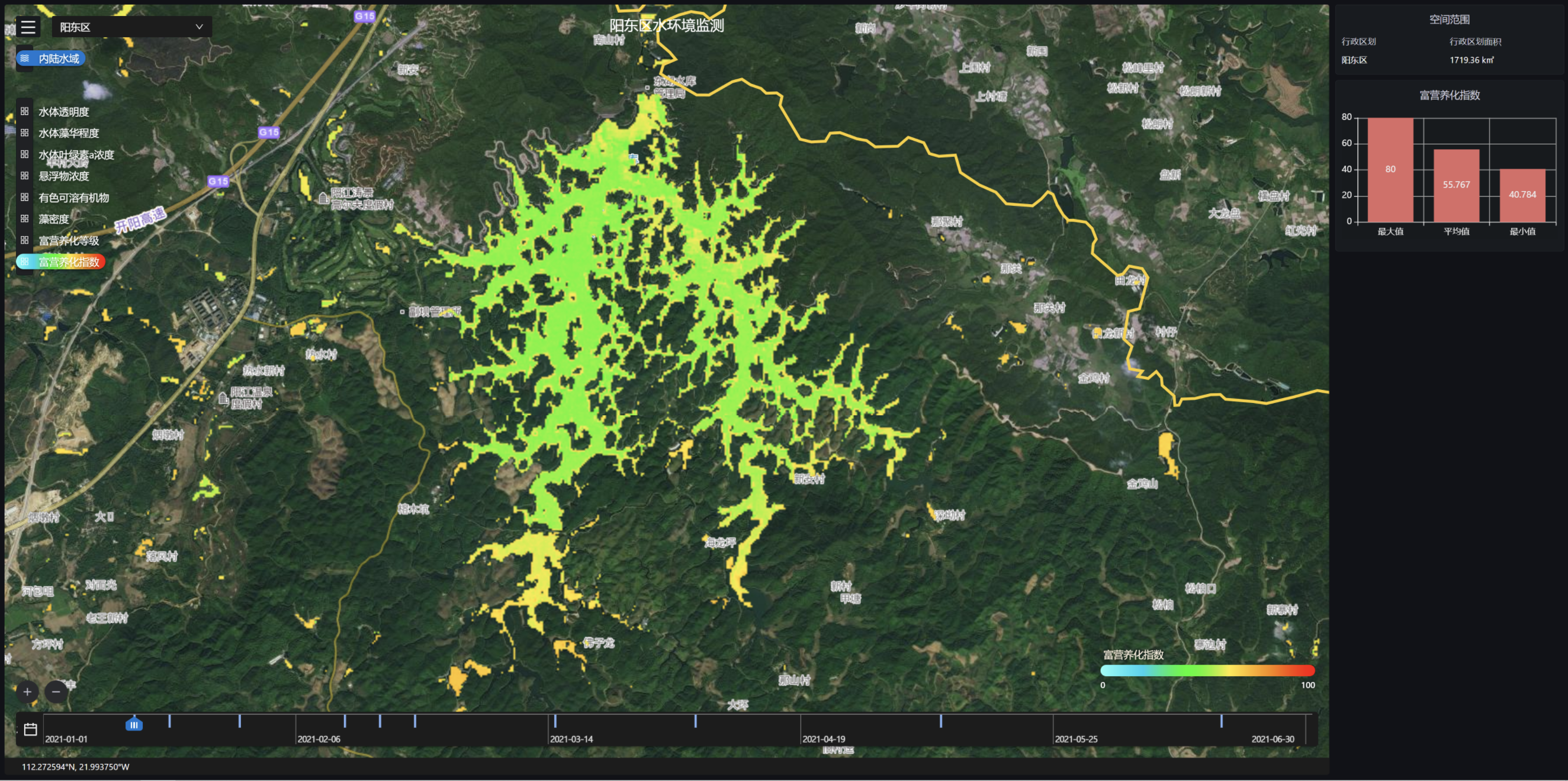
Core Index
Technical Index | Data |
|---|---|
| Data Format | Vector Raster |
| Spatial Resolution | Standard: 10 meters |
| Time Resolution | 3~5 Days |
| Servicable Area | Global |
| Service Mode | SDK, SaaS, WMTS |
| Main Data Source | TerraQuanta Multi-source Spectrum Input (TMSI) |
Black and Odorous Water Identification and Source Tracing

Core Index
Technical Index | Data |
|---|---|
| Data Format | Vector Raster |
| Spatial Resolution | Standard: 10 meters |
| Time Resolution | 3~5 Days |
| Servicable Area | Global |
| Service Mode | SDK, SaaS, WMTS |
| Main Data Source | TerraQuanta Multi-source Spectrum Input (TMSI) |
Identification of the Four Issues in Rivers and Lake
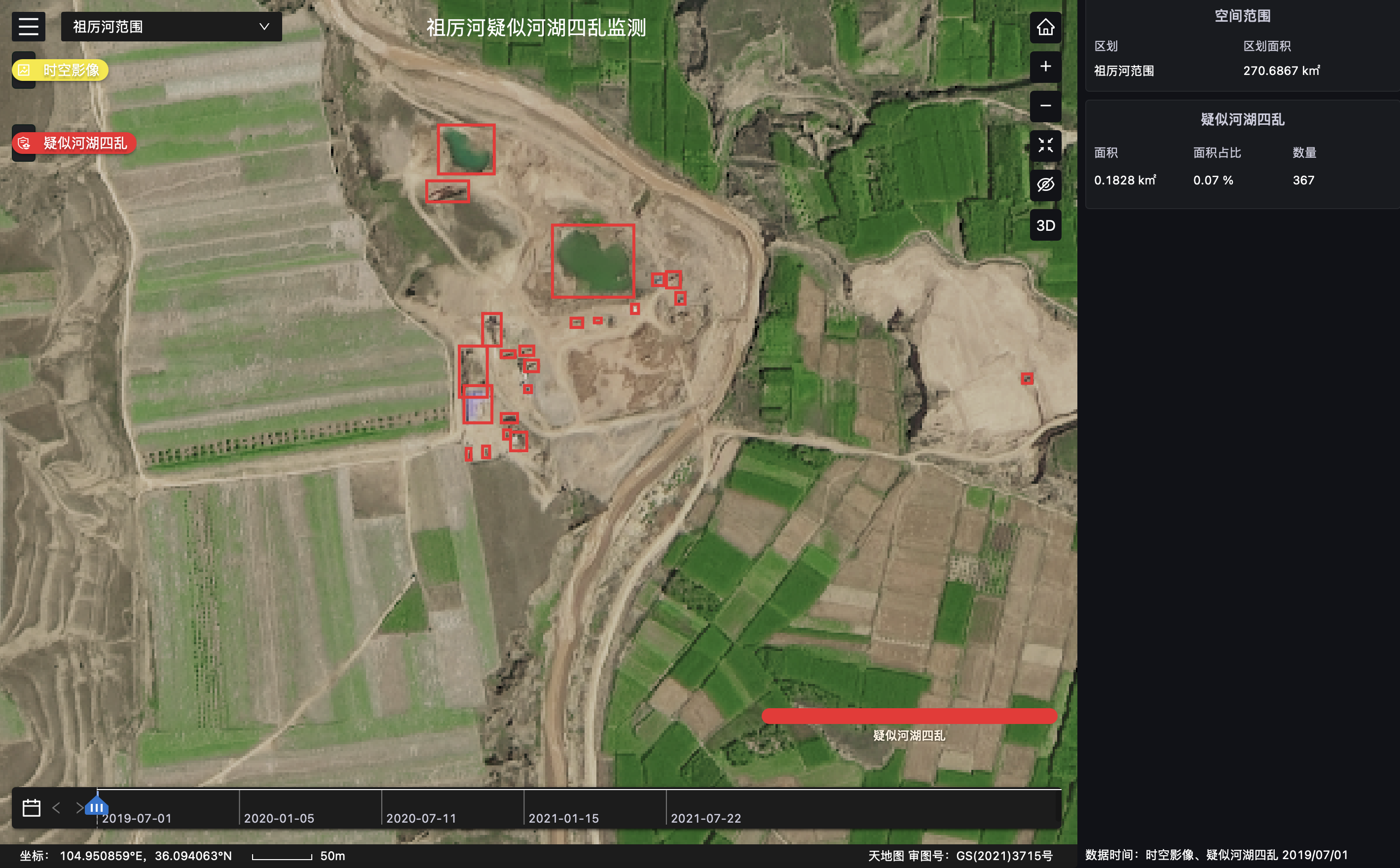
Core Index
Technical Index | Data |
|---|---|
| Data Format | Vector Raster |
| Spatial Resolution | Standard: 10 meters, Max: 0.5 meters |
| TimeResolution | Standard: Quarterly, Max: Monthly |
| Servicable Area | Global |
| Service Mode | SDK, SaaS, WMTS |
| Main Data Source | TerraQuanta Multi-source Spectrum Input (TMSI) |